Category:Braakmolen, Goor
Jump to navigation
Jump to search
| Object location | | View all coordinates using: OpenStreetMap |
|---|
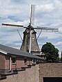
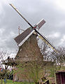
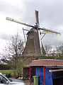
windmill in Goor, Netherlands  | |||||
| Upload media | |||||
| Instance of | |||||
|---|---|---|---|---|---|
| Location | Goor, Hof van Twente, Overijssel, Netherlands | ||||
| Street address |
| ||||
| Located on street |
| ||||
| Has use | |||||
| Heritage designation |
| ||||
| Source of energy | |||||
 | |||||
|
This is a category about rijksmonument number 16530
|
| Address |
|
Media in category "Braakmolen, Goor"
The following 108 files are in this category, out of 108 total.
-
 2019-06-13 Achterzijde Klompenmuseum Goor met Braakmolen.jpg 4,000 × 2,664; 2.42 MB
-
2020-09-12 — Braakmolen in Goor draait snel.webm 5.0 s, 1,920 × 1,080; 1.32 MB
-
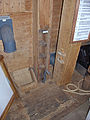
 2020-09-12 — Braakmolen, deur.jpg 3,000 × 4,000; 3.61 MB
-
 2020-09-12 — Braakmolen, doorsnedetekening.jpg 3,000 × 4,000; 2.53 MB
-
2020-09-12 — Braakmolen, Goor.webm 15 s, 1,080 × 1,920; 3.95 MB
-
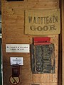 2020-09-12 — Braakmolen, stempel W.A. Otte & Zn Goor.jpg 3,000 × 4,000; 2.72 MB
-

-

-

-

-

-
-

-
 Goor Braakmolen.jpg 2,304 × 3,072; 1.28 MB
-
 Goor, molen foto5 2010-07-18 13.24.JPG 2,549 × 3,399; 4.62 MB
-
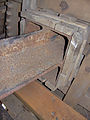
 Inrijpoort van achtkante stellingmolen - AMR Molenfoto - 20542006 - RCE.jpg 900 × 1,200; 196 KB
-
 Korenmolen, aanzicht - Goor - 20080102 - RCE.jpg 817 × 1,200; 153 KB
-
 Molen Braakmolen 31-03-2012 (1).jpg 2,126 × 2,751; 1.4 MB
-
 Molen Braakmolen 31-03-2012 (2).jpg 2,322 × 3,123; 1.76 MB
-
 Molen Braakmolen 31-03-2012 (3).jpg 2,297 × 3,102; 1.28 MB
-
 Molen Braakmolen Busselneus (1).jpg 2,448 × 3,264; 1.42 MB
-
 Molen Braakmolen Busselneus (2).jpg 2,448 × 3,264; 1.94 MB
-
 Molen Braakmolen Busselneus (3).jpg 2,351 × 3,169; 1.6 MB
-
 Molen Braakmolen elektrische installatie.jpg 2,448 × 3,264; 1.64 MB
-
 Molen Braakmolen geschiedenis.jpg 2,448 × 3,264; 1.45 MB
-
 Molen Braakmolen houten achtkant achtkantstijl (1).jpg 2,448 × 3,264; 1.43 MB
-
 Molen Braakmolen houten achtkant achtkantstijl (2).jpg 2,448 × 3,264; 2.06 MB
-
 Molen Braakmolen Jakobsladder.jpg 2,448 × 3,264; 2.48 MB
-
 Molen Braakmolen kap bovenas hals (1).jpg 3,264 × 2,448; 2.64 MB
-
 Molen Braakmolen kap bovenas hals (2).jpg 3,264 × 2,448; 2.25 MB
-
 Molen Braakmolen kap bovenas hals (3).jpg 3,264 × 2,448; 1.64 MB
-
 Molen Braakmolen kap bovenas pen zwichtboom (1).jpg 3,264 × 2,448; 2.25 MB
-
 Molen Braakmolen kap bovenas pen zwichtboom (2).jpg 2,448 × 3,264; 1.95 MB
-
 Molen Braakmolen kap bovenas penlager.jpg 3,264 × 2,448; 2.23 MB
-
 Molen Braakmolen kap bovenas spiegelgat (1).jpg 2,448 × 3,264; 1.66 MB
-
 Molen Braakmolen kap bovenwiel (1).jpg 3,264 × 2,448; 2.48 MB
-
 Molen Braakmolen kap bovenwiel achterkant.jpg 3,264 × 2,448; 1.67 MB
-
 Molen Braakmolen kap bovenwiel bonkelaar (1).jpg 3,264 × 2,448; 1.86 MB
-
 Molen Braakmolen kap bovenwiel bonkelaar (2).jpg 3,264 × 2,448; 1.98 MB
-
 Molen Braakmolen kap bovenwiel bonkelaar (3).jpg 2,448 × 3,264; 2.29 MB
-
 Molen Braakmolen kap bovenwiel bonkelaar bandvang.jpg 2,448 × 3,264; 2.69 MB
-
 Molen Braakmolen kap bovenwiel ijzerbalk (1).jpg 3,264 × 2,448; 1.97 MB
-
 Molen Braakmolen kap bovenwiel ijzerbalk (2).jpg 3,264 × 2,448; 1.81 MB
-
 Molen Braakmolen kap bovenwiel pal.jpg 2,448 × 3,264; 1.83 MB
-
 Molen Braakmolen kap koningsspil verdeler.jpg 3,264 × 2,448; 1.98 MB
-
 Molen Braakmolen kap kruineut.jpg 3,264 × 2,448; 1.95 MB
-
 Molen Braakmolen kap kruineuten achtkantstijl.jpg 2,448 × 3,264; 2.36 MB
-
 Molen Braakmolen kap kruineuten.jpg 3,264 × 2,448; 2.41 MB
-
 Molen Braakmolen kap steunder.jpg 3,264 × 2,448; 2.04 MB
-
 Molen Braakmolen kap stormschild.jpg 3,264 × 2,448; 1.86 MB
-
 Molen Braakmolen kap vang koubout (1).jpg 3,264 × 2,448; 1.63 MB
-
 Molen Braakmolen kap vang koubout (2).jpg 3,264 × 2,448; 1.69 MB
-
 Molen Braakmolen kap vang koubout (3).jpg 3,131 × 2,337; 1.18 MB
-
 Molen Braakmolen kap vang koubout bevestiging.jpg 3,264 × 2,448; 1.31 MB
-
 Molen Braakmolen kap vang lendestut.jpg 2,448 × 3,264; 1.77 MB
-
 Molen Braakmolen kap vangbalk ezel (1).jpg 3,264 × 2,448; 1.95 MB
-
 Molen Braakmolen kap vangbalk ezel.jpg 2,448 × 3,264; 1.53 MB
-
 Molen Braakmolen kap vangbalk koebout sabelijzer.jpg 2,448 × 3,264; 1.96 MB
-
 Molen Braakmolen kap voeghout linker.jpg 2,448 × 3,264; 1.79 MB
-
 Molen Braakmolen koningsspil donsbalk steenrondsel.jpg 3,264 × 2,448; 1.62 MB
-
 Molen Braakmolen koningsspil donsbalk.jpg 3,264 × 2,448; 1.85 MB
-
 Molen Braakmolen luiwerk en mengketel aandrijving (2).jpg 3,264 × 2,448; 2.46 MB
-
 Molen Braakmolen luiwerk en mengketel aandrijving elektromotor.jpg 2,448 × 3,264; 2.21 MB
-
 Molen Braakmolen luiwerk en mengketel aandrijving spoorwiel.jpg 3,264 × 2,448; 2 MB
-
 Molen Braakmolen luiwerk en mengketel aandrijving.jpg 3,264 × 2,448; 1.68 MB
-
 Molen Braakmolen maalkoppel aandrijving elektrisch (1).jpg 3,264 × 2,448; 2.54 MB
-
 Molen Braakmolen maalkoppel aandrijving elektrisch (2).jpg 3,264 × 2,448; 2.02 MB
-
 Molen Braakmolen maalkoppel aandrijving elektrisch (3).jpg 3,196 × 2,376; 2.04 MB
-
 Molen Braakmolen maalkoppel kropgat.jpg 3,264 × 2,448; 2.71 MB
-
 Molen Braakmolen maalkoppel licht maalbak.jpg 2,448 × 3,264; 2.57 MB
-
 Molen Braakmolen maalkoppel regulateur (1).jpg 2,448 × 3,264; 2.59 MB
-
 Molen Braakmolen maalkoppel regulateur spoorwiel.jpg 3,264 × 2,448; 2.82 MB
-
 Molen Braakmolen maalkoppel spoorwiel.jpg 3,264 × 2,448; 2.49 MB
-
 Molen Braakmolen maalkoppel steenkraan.jpg 2,448 × 3,264; 3.05 MB
-
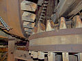
 Molen Braakmolen maalkoppel steenrondsel.jpg 3,264 × 2,448; 1.95 MB
-
 Molen Braakmolen maalkoppel steenspil.jpg 2,264 × 3,073; 1.43 MB
-
 Molen Braakmolen maalkoppel.jpg 2,448 × 3,264; 2.14 MB
-
 Molen Braakmolen mengketel (1).jpg 3,264 × 2,448; 2.01 MB
-
 Molen Braakmolen mengketel (2).jpg 2,448 × 3,264; 1.83 MB
-
 Molen Braakmolen mengketel hout.jpg 2,355 × 3,208; 2.01 MB
-
 Molen Braakmolen staart (1).jpg 2,448 × 3,264; 2.18 MB
-
 Molen Braakmolen staart (2).jpg 2,448 × 3,264; 1.58 MB
-
 Molen Braakmolen staart achterkeuvelens.jpg 3,264 × 2,448; 1.52 MB
-
 Molen Braakmolen stelling kruiketting.jpg 3,264 × 2,448; 4.3 MB
-
 Molen Braakmolen stelling kruiwiel (1).jpg 2,251 × 3,101; 1.32 MB
-
 Molen Braakmolen stelling kruiwiel.jpg 3,081 × 2,231; 1.15 MB
-
 Molen Braakmolen stelling staanders (1).jpg 2,448 × 3,264; 2.06 MB
-
 Molen Braakmolen stelling staanders.jpg 2,358 × 3,197; 2.76 MB
-
 Molen Braakmolen stelling weeg.jpg 3,264 × 2,448; 2.96 MB
-
 Molen Braakmolen stellingdeur.jpg 2,351 × 3,194; 2.49 MB
-
 Molen Braakmolen tekening.jpg 1,461 × 2,512; 934 KB
-
 Molen Braakmolen Ten Have klep (1).jpg 2,301 × 3,166; 1.18 MB
-
 Molen Braakmolen Ten Have klep (2).jpg 3,264 × 2,448; 1.92 MB
-
 Molen Braakmolen Ten Have klep (5).jpg 3,264 × 2,448; 1.01 MB
-
 Molen Braakmolen Ten Have klep en Busselneus (1).jpg 3,264 × 2,448; 1.4 MB
-
 Molen Braakmolen Ten Have klep en Busselneus (2).jpg 2,448 × 3,264; 2.61 MB
-
 Molen Braakmolen Ten Have klep en Busselneus spin (1).jpg 3,264 × 2,448; 1.76 MB
-
 Molen Braakmolen Ten Have klep en Busselneus spin (2).jpg 3,264 × 2,448; 1.66 MB
-
 Molen Braakmolen Ten Have klep.jpg 3,056 × 2,141; 851 KB
-
 Molen Braakmolen toegangsdeur.jpg 2,448 × 3,264; 2.41 MB
-
 Molen Braakmolen, Goor molensteen gatenscherpsel (2).jpg 3,264 × 2,448; 2.81 MB
-
 Molen Braakmolen, Goor molensteen gatenscherpsel.jpg 2,921 × 2,098; 2.1 MB
-
 Molenaarshuis, linker zijgevel - Goor - 20080110 - RCE.jpg 1,200 × 1,200; 331 KB
-

-
 Overzicht - Goor - 20362254 - RCE.jpg 1,200 × 1,186; 374 KB
-
 Overzicht - Goor - 20362255 - RCE.jpg 1,195 × 1,200; 385 KB
-
 Overzicht - Goor - 20362256 - RCE.jpg 1,200 × 1,189; 363 KB
-


.jpg)
.jpg)
.jpg)
.jpg)
.jpg)
.jpg)


.jpg)
.jpg)

.jpg)
.jpg)
.jpg)
.jpg)
.jpg)

.jpg)
.jpg)

.jpg)
.jpg)
.jpg)

.jpg)
.jpg)


.jpg)
.jpg)
.jpg)


.jpg)


.jpg)


.jpg)
.jpg)
.jpg)


.jpg)


.jpg)
.jpg)

.jpg)
.jpg)


.jpg)

.jpg)


.jpg)
.jpg)
.jpg)
.jpg)
.jpg)
.jpg)
.jpg)


.jpg)


